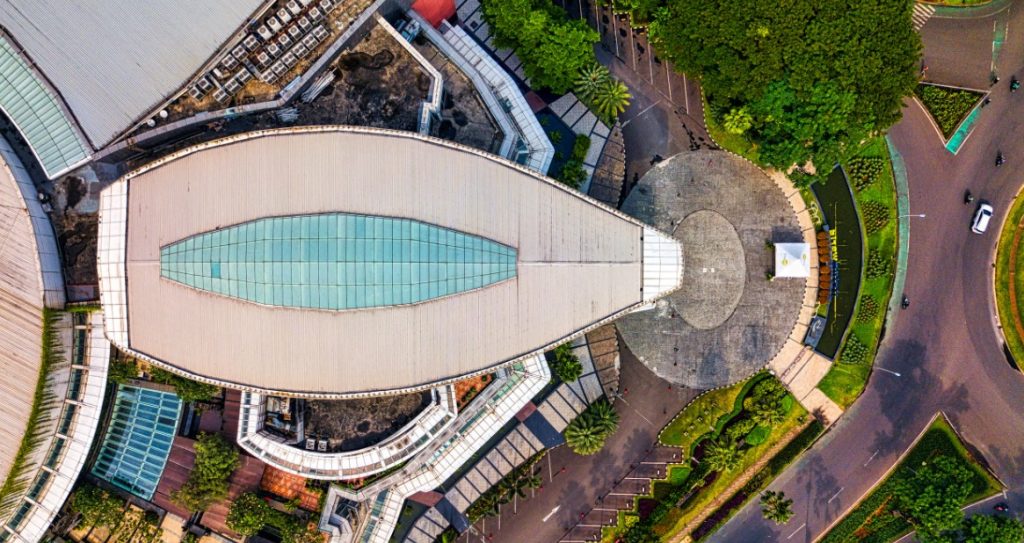
The real estate sector doesn’t shy away from innovation. In recent years, major players have explored artificial intelligence for property valuation and greener construction and design practices. Satellite imagery is another fascinating area getting considerable attention in this sector.
This technology can benefit both real estate developers and customers by offering solutions and novel perspectives on residential and commercial properties.
But how exactly can high-resolution satellite images of stunning spaces benefit the sector beyond offering an immersive tour or a thrilling multimedia experience?
Let’s unravel some high-potential possibilities.
Identify Emerging Real Estate Hotspots
Satellite images can give real estate developers a head start on promising new destinations their competitors may not have mapped out yet. Consider the depth of information a high-resolution satellite image can provide:
- Track new infrastructure projects, such as roadways, to identify trends.
- Monitor vehicle activity to locate possible areas of urban growth.
- Map areas with low real estate density or a lack of competitive activity that otherwise tick the boxes for environmental safety.
Armed with these insights, real estate firms can build smarter business development plans in an industry where making the first move can be a significant advantage.
Let Clients Monitor Construction Progress and Listing Legitimacy
What if property developers could share real-time updates with their customers beyond routine mailers and “site visit” photographs?
Imagine the difference that crisp and detailed satellite images of the property can make to a customer’s sentiment about the project. They can get updated information about the site of their dream home, including ongoing earthworks and roof development. This brings legitimacy to the project and reassures clients in this age of skepticism and frequent malpractice reports.
Firms can also use the images to check the status of large construction projects between visits. This lets them compare actual on-the-ground progress against reported milestones.
According to 2026 data released by the US National Association of Realtors, the homebuying market can finally expect solid double-digit growth. This is encouraging after a prolonged low period. Using satellite technology to partner with prospective customers as they consider buying a home can be a strategic advantage.
Locate Unexplored Areas With Good Potential
How about mapping areas with limited real estate development that may become prominent destinations in the future? Identification can be challenging without supporting data, as it is too reliant on intuition.
However, satellite imagery lets firms use geospatial services to detect signs that future real estate development is feasible. These signs could be:
- Growing industry sprawl
- Foot traffic
- Preliminary construction of homes or roads that indicate peri-urban zones
Real estate companies can also use a satellite API to gauge environmental signals that determine a potential area’s suitability for construction projects.
SkyFi is a platform with API access that can connect applications to geospatial services. This allows organizations single-point access to the imagery they want, obtained from satellites and aerial sources.
For example, images can illustrate a site’s proximity to water bodies and help firms examine flood risk. They can also help firms conduct wildlife vulnerability assessments and assess soil health.
Help Address the Problem of Urban Heat Hotspots
For the real estate sector, environmental concerns remain a perpetual challenge. Regardless of how green a firm’s construction practices may be, it is hard to overlook the unavoidable contribution to global warming.
According to 2025–2026 UNEP data, buildings and construction account for approximately 37 percent of global CO₂ emissions. These sectors also constitute nearly 50 per cent of global material extraction.
Interestingly, satellite imagery can be a powerful tool for real estate developers to cool down urban heat hotspots. By combining thermal satellite data with building density, firms can map hotter neighborhoods. They can plan green-building initiatives, such as reflective roofs, accordingly. The focus will be on properties and regions that require climate resilience the most.
A feature in the US Green Building Council notes that client demand for sustainable spaces is also rising.
“Climate regulations and investors are fueling demand for low-carbon assets. There has been an increase in tenants’ willingness to pay more for Class A sustainable spaces compared to non-sustainable spaces.” – Deborah Cloutier, Real Estate Expert.
This approach can also be cost-effective as the initiatives are more precisely targeted according to cooling needs. It makes green initiatives stronger and minimizes the risk of greenwashing.
Satellite Imagery Use Cases for Real Estate: An Overview
| Use case | How satellite imagery helps |
| Identify emerging hotspots | Track new roads, urban expansion, and development trends to discover promising investment locations. |
| Monitor construction progress | Compare images over time to track building progress and verify visible site developments. |
| Locate undiscovered areas | Identify undeveloped land, expanding industrial zones, and environmental features to assess future growth potential. |
| Address the urban heat hotspot problem | Track areas needing urgent climate resilience and integrate green initiatives into construction projects. |
FAQs
Can real estate professionals use satellite imagery to analyze competitors?
Yes. Property developers and investors can study nearby construction projects, new commercial developments, and expanding residential areas. They can also assess land-use changes over time. This can help them understand competing projects in the region and evaluate market opportunities they can tap into.
What is the difference between satellite imagery and drone imagery in real estate?
Satellite imagery supports regional analysis, historical comparisons, and monitoring large areas. Drone imagery typically provides more detailed, flexible views of individual properties and construction sites. The best choice depends on the required resolution, coverage, cost, and update frequency.
How can AI make satellite imagery more useful for real estate?
AI can analyze satellite images to detect buildings, classify land use, identify construction activity, and measure vegetation changes. Real estate firms can compare development patterns over time. Combining AI insights with real estate market data can support faster, more informed decisions.
Combining Imagery With Intelligence
For real estate and allied sectors, satellite imagery can be a powerful tool for planning new projects, tracking ongoing ones, and understanding environmental responsibility.
However, combining imagery with intelligence (both human and artificial) is essential to gain a true edge. Analyzing available data and deriving actionable insights helps real estate firms shape a meaningful future.