A two-dimensional plan can be technically clear and still be difficult to imagine.
Architects and designers can read walls, circulation, setbacks, and room relationships quickly. Many homeowners, buyers, and investors cannot. A floor plan may show where the kitchen sits, but not how open it will feel once furnished. A site plan may show the house, garage, driveway, and garden boundaries, yet still leave viewers unsure how the property will come together.
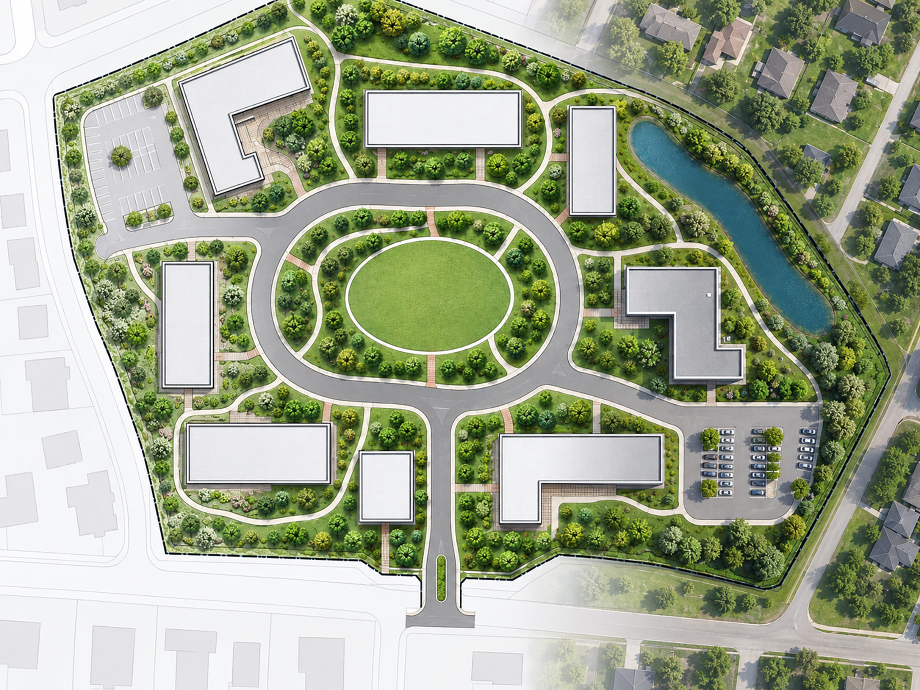
That gap between technical information and visual understanding is where AI visualization can help.
It does not replace architectural drawings, surveys, planning documents, or professional design work. Instead, it adds a presentation layer that can make an existing plan easier to understand and discuss before major decisions become expensive.
One Upload Can Represent Different Intentions
“AI plan visualization” often sounds like one task, but users may be trying to achieve different outcomes.
The first is visualizing an existing plan. The user wants to add color, furniture, landscaping, or an isometric presentation while keeping the main structure recognizable.
The second is developing a concept from a rough reference. The user may upload a lot diagram, satellite image, or early sketch and describe a desired home, garage, pool, garden, terrace, or outdoor living area. Here, the source provides boundaries and context while the written brief guides a more exploratory concept.
These workflows should not be confused.
A visualization is judged by how well it preserves room relationships, building footprints, paths, and major proportions. A concept image is judged by how clearly it communicates a possible direction.
Platforms such as ImagineMyHouse bring these workflows into a broader home-design environment, allowing users to work with room photos, floor plans, site layouts, and property concepts in one place.
Floor Plans and Site Plans Answer Different Questions
A floor plan focuses on the interior organization of a home. It helps people evaluate room connections, circulation, furniture fit, and whether a spare room could serve another purpose.
A site or lot plan focuses on the relationship between the building and the land around it. It can clarify the position of the house and garage, driveway access, garden zones, terraces, pools, paths, street frontage, and neighboring boundaries.
A black-and-white drawing may contain all of this information and still feel abstract. A colored plan, furnished top view, landscaped site plan, or aerial concept can make the same information easier to interpret.
The aim is not to make the plan more “correct.” It is to make it more legible to people who do not work with architectural drawings every day.
What AI Adds to an Existing Plan
Traditional visualization may require rebuilding a plan as a controlled 3D model, adding materials and furniture, setting cameras, and producing renders. That remains the right approach when dimensional accuracy is essential.
Early in a project, however, the immediate need may be simpler: create a visual clear enough to discuss.
AnAI plan visualizer can turn an existing floor, garden, site, or master plan into a colored top-down plan, furnished layout, isometric cutaway, landscaped site plan, aerial property concept, or architectural illustration.
A top-down visualization stays closest to the source and is easiest to compare with the original drawing. An isometric view adds depth and makes walls, furniture, and room relationships easier to understand. An aerial property concept can show how the house, garage, garden, pool, paths, and outdoor amenities relate to one another.
As the image becomes more immersive, it also becomes more interpretive. Every result should therefore remain connected to the source plan.
A Practical Visualization Workflow
A useful process begins by deciding what must remain fixed and what may be explored.
Start With a Clear Source
The plan should have readable walls, boundaries, openings, and labels. If it is a scan or photograph, perspective distortion should be corrected where possible. Unnecessary title blocks and surrounding interface elements should be cropped out.
Define the Goal
Decide whether the task is to preserve and present an existing plan or to use a rough plan or site reference as the basis for a new concept. This distinction changes how the result should be judged.
State the Fixed Elements
For a floor plan, fixed elements may include walls, stairs, doors, windows, kitchens, and bathrooms. For a site plan, they may include lot boundaries, the building footprint, driveway, garage, street access, mature trees, or neighboring structures.
Choose the Right View
Use a colored top view when room functions and circulation matter most. Use an isometric view when viewers need help understanding depth. Use an aerial property concept when the relationship between buildings and outdoor spaces is the main subject.
Compare the Result With the Original
Check boundaries, walls, openings, stairs, driveways, paths, and major proportions. A visually attractive result is not useful if it quietly changes the structure the discussion is supposed to preserve.
Refine One Area
Once a complete plan is understandable, a user may want to change only one part: turn a spare room into a bathroom, revise the garden, reposition a pool, or test a different garage arrangement.
Focused edits make the process feel more like a design conversation and less like repeated random generation.
Where Plan Visualization Creates Value
For homeowners, it can make an architect’s or contractor’s drawing easier to discuss before materials and furniture are selected.
For buyers, a furnished plan can clarify whether a property supports the intended lifestyle, especially when listing photographs do not show how rooms connect.
For developers and real estate teams, a landscaped site plan or aerial concept can communicate the potential of an unfinished property more quickly than linework alone.
For architects and designers, AI visualization can provide fast presentation alternatives during early conversations, before a concept deserves a fully controlled model and detailed render.
The value comes from communication. The image gives different people a shared visual reference.
What an AI Visualization Is Not
An AI-generated plan image should not be treated as the authoritative source for exact measurements, structural engineering, permit submissions, building-code compliance, electrical or plumbing layouts, accessibility, construction quantities, pricing, or final material specifications.
It may also introduce errors. Walls can shift, doors can disappear, room proportions can drift, and furniture can appear at an unrealistic scale.
The source drawing, measured information, site conditions, and professional review still control every real construction decision.
From Reading a Plan to Understanding a Property
A plan explains where spaces and structures are located. Visualization helps people understand what those spaces and structures might become.
A productive workflow is simple: begin with the clearest available plan, decide whether the goal is preservation or exploration, identify the elements that must remain fixed, choose a suitable presentation view, compare the result with the source, refine selected areas, and return to verified drawings for every technical decision.
AI cannot remove uncertainty from design and development. Used carefully, it can make that uncertainty visible enough to discuss earlier—and resolve more intelligently. That is the practical role ImagineMyHouse is built to support: helping people move from technical plans to clearer property visuals while keeping the source plan central to every decision.