Hurricane Katrina flooded 80% of New Orleans by August 31, 2005, submerging entire neighborhoods under as much as 15 feet of water. Levee failures along three major canals turned below-sea-level communities into holding basins that took weeks to drain. Yet the Garden District and French Quarter, both situated on the Mississippi River’s natural levee, escaped the catastrophic flooding entirely because their ground sits above sea level.
Two decades after watching that divide unfold firsthand, hotelier Robert Balzebre opened a boutique hotel on that same elevated terrain.
“This is probably the poster child for big disasters after Hurricane Katrina, which I also was here at the time,” Balzebre said.
Katrina Revealed What Elevation Protects and What It Doesn’t
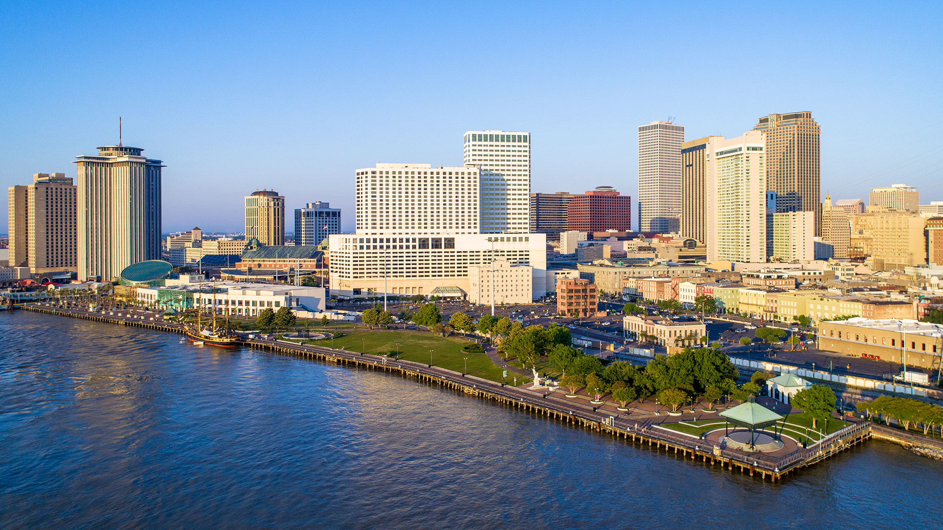
New Orleans was founded in 1718 on the highest ground available, the natural levee formed by centuries of Mississippi River sediment deposits. Riverside neighborhoods, including the French Quarter and Garden District, sit 8 to 12 feet above sea level. A LIDAR study led by Tulane University geographer Richard Campanella confirmed that 51% of the urbanized portions of Orleans Parish rest at or above sea level, with the highest terrain following the crescent shape of the river.
Areas situated farther from the river, such as Lakeview, Gentilly, and New Orleans East, were established on what were formerly drained cypress swamps. Development began in the mid-20th century. When the pumps were eventually taken out, the water table dropped, causing the organic matter in the soil to dry out, compress, and ultimately collapse.
Parts of Lakeview sank 5 to 8 feet below sea level. Sections of New Orleans East dropped 6 to 12 feet.
When Katrina’s storm surge breached floodwalls along the 17th Street Canal, London Avenue Canal, and Industrial Canal, water rushed into these depressions and pooled. Riverside neighborhoods sustained wind damage but avoided prolonged submersion.
Robert Balzebre Built New Construction on Stable, Elevated Soil
Robert Balzebre chose the Garden District for his newest hotel after weighing both tourism appeal and geographic durability. His Miami Beach property, the Kimpton Surfcomber, required a $35 million historic renovation of an existing Art Deco structure. The New Orleans project took the opposite approach, opting for ground-up construction.
“I’ve also just opened this year a boutique hotel here in New Orleans in the Garden District, separate on higher ground and other parts of the city for sure, but in a still tourist-friendly area that people want to be in,” Balzebre said.
That higher ground also means better soil. Sandy and silty deposits from the Mississippi compact far less than the organic peat beneath drained swamp neighborhoods. Foundations on the river’s natural levee face a lower subsidence risk and hold their elevation over decades rather than sinking each year incrementally.
How Far Has the City Sunk Since Katrina?
A June 2025 Tulane University study published in Science Advances used 18 years of satellite radar data to produce the most detailed subsidence map of Greater New Orleans ever assembled. Researchers tracked elevation shifts across the metro area from 2002 to 2020 and found that certain sections lose up to 47 millimeters of elevation annually, nearly two inches per year.
“These results are a wake-up call,” said co-author Prof. Mead Allison of Tulane. “We need ongoing monitoring and maintenance to ensure that our flood defenses don’t lose their level of protection beneath us.”
Subsidence concentrates in predictable locations. Areas near Louis Armstrong International Airport registered 27 millimeters of annual sinking from recent construction compacting soft soils. Neighborhoods converted from marshland continue their downward trend as buried organic material decomposes.
Wetlands east of the city are disappearing so quickly that some could become open water within a decade.
The riverside high ground tells a different story. The Garden District terrain where Balzebre placed his hotel has remained comparatively stable for centuries.
$14.5 Billion in Flood Defenses Cannot Outrun Sinking Ground
After Katrina exposed catastrophic engineering failures, Congress funded the Hurricane and Storm Damage Risk Reduction System. Completed in 2022, the project delivered 350 miles of levees, floodwalls, surge barriers, and pumping stations designed to withstand a 100-year storm.
Tulane’s satellite study uncovered a complication that engineers did not fully anticipate. Newly poured concrete floodwalls are sinking faster than older earthen levees that were simply raised after Katrina. Some segments of the protection system are losing elevation faster than the sea is rising, reducing their designed capacity.
Even before those findings, RAND Corporation research published after Katrina concluded that levees, floodwalls, pumps, and floodgates alone cannot shield the city from all possible surge events. Nonstructural measures, including incentives to build on higher ground and restrictions on floodplain development, remain essential complements to physical barriers.
“If something is just blatantly too risky or obviously not geographically set for the long run in the right way, then I would choose not to do that development,” Robert Balzebre said.
Louisiana’s Insurance Crisis Penalizes Low-Lying Properties
Twelve Louisiana insurers became insolvent between 2020 and 2022 after Hurricanes Laura, Delta, Zeta, and Ida caused catastrophic wind and flood losses. Orleans Parish residents insured through Louisiana Citizens, the state’s insurer of last resort, now pay an average of $4,884 per policy. Louisiana ranks as the third most expensive state for homeowners’ insurance, and premiums have risen nearly 100% above inflation-adjusted post-Katrina levels.
Flood insurance costs correlate directly with elevation. Properties sitting below the base flood elevation face the highest National Flood Insurance Program premiums, while structures on higher ground qualify for significantly lower rates. For a hotel with dozens of rooms operating over a 30- or 50-year horizon, that annual difference compounds into a substantial competitive advantage.
Robert Balzebre’s career has spanned three of the most insurance-stressed markets in the country, including South Florida, Southern California, and Louisiana.
What Makes a Hotel Site Viable for Decades?
Robert Balzebre has not avoided high-risk markets entirely.
“I obviously have chosen probably some of the worst possible danger zones for natural disasters, but I love all these different places for the unique characteristics, and that’s why I’m here,” Balzebre said.
His Garden District property sits in a neighborhood visitors seek out for its 19th-century mansions, oak-lined streets, and proximity to the St. Charles Avenue streetcar line. The ground beneath the hotel has supported continuous habitation since before the Civil War without catastrophic flood loss.
Tulane geographer Campanella has argued that topographic elevation is a scarce resource that should be prioritized for occupancy. Neighborhoods above sea level offer an inherent safety margin that no engineered barrier can permanently replicate.
Construction Cannot Create Elevation
Federal flood defenses are sinking alongside the neighborhoods they protect. Insurers continue to exit. Premiums keep climbing.
Robert Balzebre’s New Orleans hotel sits on the same high ground that kept its neighbors dry while the surrounding city went underwater. Fire-resistant materials can harden a structure in Los Angeles. Hurricane-rated glass can shield a building in Miami Beach. New Orleans demands a more elemental calculation. No material upgrade compensates for a foundation that loses elevation year after year.