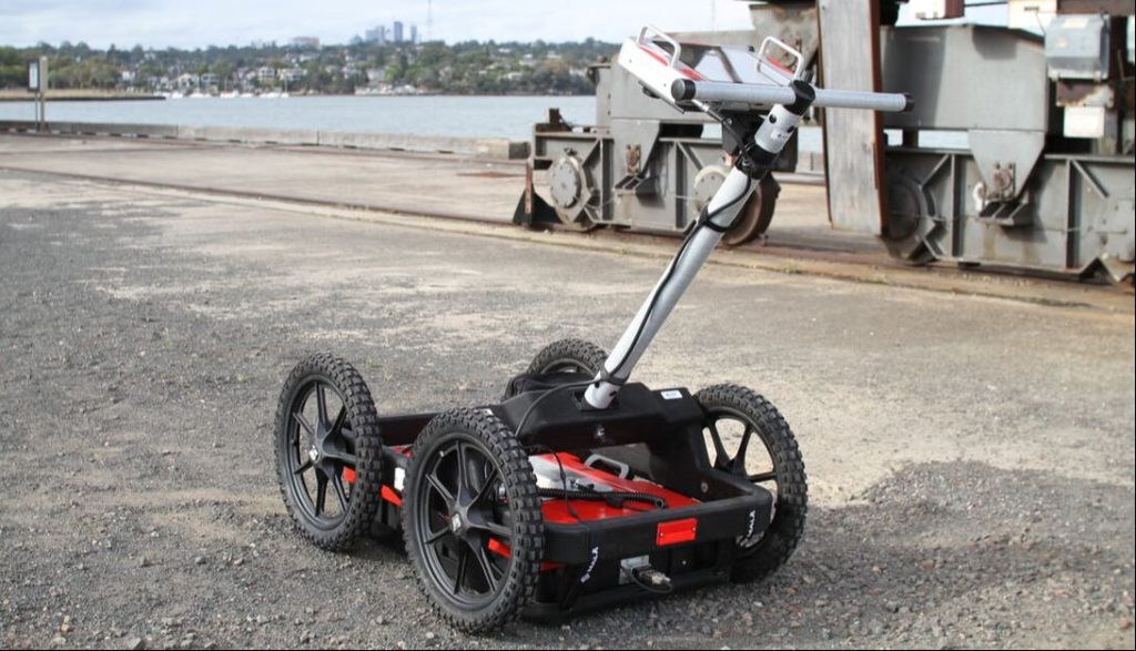
Professional GPR systems are used to scan beneath surfaces for objects, utilities, or structures hidden underground. Learning how these systems function and understanding their uses can decrease the chances of costly mistakes during projects. Knowing what to avoid when using professional GPR systems helps users work more effectively and safely.
Selecting the right professional GPR systems is an important step for any project needing subsurface exploration. Being aware of common pitfalls can help both new and experienced operators get the best results from their equipment.
1. Failing to conduct comprehensive site surveys before GPR deployment
When a site survey is skipped before using GPR, mistakes are more likely. The team can miss hidden features underground. These surprises can cause problems during data collection and lead to delays.
A proper site review helps people understand the area. It points out possible obstacles, underground utilities, or areas where GPR might struggle. Without this first step, scanning can miss targets or give incorrect results.
A survey also helps choose the right GPR settings and guides how to move the equipment across the site. Teams that do not check the site first may waste time repeating scans or risk damaging equipment. This step can be the difference between a smooth project and unexpected problems.
2. Ignoring soil conductivity impacting GPR depth penetration
Soil conductivity has a big effect on how deep a GPR system can scan. Some soils, like clay, hold more water and minerals, which increases conductivity. High conductivity in the ground absorbs radar signals and causes the signal to fade faster.
Dry, sandy soils have lower conductivity and usually let signals travel farther. If operators ignore the type of soil, they may miss important details underground. They might expect deeper scans but get shallow results instead.
Adjusting GPR settings for the soil type helps improve the chance of finding what is underground. Checking soil conditions before a scan lets users pick the right approach and avoid mistakes. Remember, knowing the soil is as important as the settings on the GPR unit.
3. Relying on outdated subsurface data during analysis
Old subsurface data can mislead operators during analysis. The ground below a site can change due to new construction, repairs, or erosion. Using old maps or survey results may result in missed or misidentified features.
It is important to check if the subsurface information is current before starting a project. New obstacles or changes might not be shown in old data. This can lead to errors or even safety risks if workers trust the outdated information.
Even minor changes underground, like soil movement or utility work, can affect results. Operators should match fresh data from the site with previous records when available. This extra step helps catch differences and increases the accuracy of the analysis.
4. Using improper antenna frequency for target depth and size
Choosing the wrong antenna frequency is a common mistake when using ground penetrating radar systems. Each antenna frequency has its own strength for finding certain sizes and depths of targets.
Lower frequencies can reach deeper below the surface but may miss small or thin objects. Higher frequencies can show more detail but won’t reach as far underground.
The right frequency depends on what the user is trying to find. If details close to the surface are needed, a higher frequency works better. For deeper objects, a lower frequency is often best.
A mixed area with both deep and shallow targets may need testing with different antennas. Changing frequencies for different surveys will help avoid missing important features.
Using an improper frequency can lead to poor data and missed items underground, which wastes both time and resources. Always match the antenna frequency to the required task for better results.
5. Neglecting to calibrate equipment for specific ground conditions
Calibration is an important step when setting up GPR systems. Different soil types and moisture levels can affect how signals travel and are received.
If equipment is not calibrated for the specific ground conditions, the results may be inaccurate or misleading. For example, clay, sand, or rocky soils can change how deep or clear the data appears.
Skipping calibration can also lead to missing shallow or deep targets. Small differences in settings can cause errors in mapping underground features.
Calibrating the equipment before each use allows for better readings and helps the operator trust the survey data. Even a small change in ground conditions can require a new setup.
Operators should always adjust settings and check the calibration before starting a new scan. This habit improves the quality of the information collected and helps avoid mistakes later on.
Conclusion
Using professional GPR systems requires attention to detail and careful planning. By avoiding common mistakes like using the wrong settings, not checking soil conditions, or ignoring weather, users can get more useful data.
It helps to follow a checklist, double-check results, and keep equipment in good shape. Staying aware of these points supports safe and successful GPR surveys.
